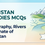
Pakistan Studies MCQs – Geography, Rivers & Climate
Test your knowledge of Pakistan’s geography with 10 MCQs covering provinces, rivers, mountains, climate, borders, and natural resources.
0 of 10 answered0%
⏱ 10:00
Score: 0/10
Q1
What is the total area of Pakistan?
✓ B – 796,095 km²
Pakistan’s total area is approximately 796,095 km². It is the 33rd largest country in the world by area. China is its neighbor to the northeast across the Karakoram range.
Pakistan’s total area is approximately 796,095 km². It is the 33rd largest country in the world by area. China is its neighbor to the northeast across the Karakoram range.
Q2
Which is the longest river in Pakistan?
✓ C – Indus
The Indus River is the longest river in Pakistan, flowing about 3,180 km total (about 2,900 km within Pakistan). It originates in Tibet and flows through Pakistan into the Arabian Sea.
The Indus River is the longest river in Pakistan, flowing about 3,180 km total (about 2,900 km within Pakistan). It originates in Tibet and flows through Pakistan into the Arabian Sea.
Q3
Which mountain range contains K2, the world’s second highest peak?
✓ C – Karakoram
K2 (8,611 m) is located in the Karakoram Range on the Pakistan-China border in Gilgit-Baltistan. It is the second highest peak in the world after Mount Everest (Nepal).
K2 (8,611 m) is located in the Karakoram Range on the Pakistan-China border in Gilgit-Baltistan. It is the second highest peak in the world after Mount Everest (Nepal).
Q4
Which province of Pakistan is the largest by area?
✓ D – Balochistan
Balochistan is the largest province of Pakistan by area (~347,190 km²), making up about 44% of Pakistan’s total land area. However, it has the smallest population.
Balochistan is the largest province of Pakistan by area (~347,190 km²), making up about 44% of Pakistan’s total land area. However, it has the smallest population.
Q5
Pakistan shares its eastern border with:
✓ C – India
Pakistan’s eastern border is shared with India (the border is called the International Boundary, and the Line of Control separates Pakistani and Indian-administered Kashmir).
Pakistan’s eastern border is shared with India (the border is called the International Boundary, and the Line of Control separates Pakistani and Indian-administered Kashmir).
Q6
The capital city of Pakistan is:
✓ C – Islamabad
Islamabad is the capital of Pakistan, built in the 1960s to replace Karachi as the capital. It is located in the Potohar Plateau region and is a planned modern city.
Islamabad is the capital of Pakistan, built in the 1960s to replace Karachi as the capital. It is located in the Potohar Plateau region and is a planned modern city.
Q7
Which sea lies to the south of Pakistan?
✓ B – Arabian Sea
The Arabian Sea (part of the Indian Ocean) lies to the south of Pakistan. Pakistan has a coastline of about 1,046 km along the Arabian Sea, including the port city of Karachi.
The Arabian Sea (part of the Indian Ocean) lies to the south of Pakistan. Pakistan has a coastline of about 1,046 km along the Arabian Sea, including the port city of Karachi.
Q8
The Thar Desert is located in which province?
✓ C – Sindh
The Thar Desert extends across southeastern Sindh into Rajasthan (India). It is one of the world’s most populated deserts. The Pakistani portion is called the Thar or Cholistan desert.
The Thar Desert extends across southeastern Sindh into Rajasthan (India). It is one of the world’s most populated deserts. The Pakistani portion is called the Thar or Cholistan desert.
Q9
Which canal system in Pakistan is the largest in the world?
✓ B – Indus Basin Irrigation System
The Indus Basin Irrigation System is the largest contiguous irrigation system in the world. It was significantly developed after the Indus Waters Treaty (1960) between Pakistan and India.
The Indus Basin Irrigation System is the largest contiguous irrigation system in the world. It was significantly developed after the Indus Waters Treaty (1960) between Pakistan and India.
Q10
The Khyber Pass connects Pakistan with:
✓ D – Afghanistan
The Khyber Pass is a mountain pass connecting Peshawar (Pakistan) with Jalalabad (Afghanistan). It has been a crucial trade and military route for centuries and is located in the Hindu Kush range.
The Khyber Pass is a mountain pass connecting Peshawar (Pakistan) with Jalalabad (Afghanistan). It has been a crucial trade and military route for centuries and is located in the Hindu Kush range.
About These Pakistan Studies MCQs
These Pakistan Studies Geography MCQs are designed for students in Class 9 & 10. They cover Pakistan’s provinces, rivers, mountains, borders, climate, and natural features.
Pakistan Studies is a compulsory subject in board exams. Geography questions — especially about rivers, mountain ranges, and provinces — are frequently tested and carry significant marks.
Topics Covered
- Pakistan’s area and provinces
- Major rivers — Indus, Jhelum, Chenab, Ravi
- Mountain ranges — Karakoram, Himalayas, Hindu Kush
- Borders — India, Afghanistan, Iran, China
- Climate zones and deserts
- Capital city and major cities
Board Exam Strategy
Memorize Pakistan’s 4 provinces and their capitals, the 5 major rivers of the Indus system, and the key mountain peaks. Map-based questions are common — practice labeling Pakistan’s map regularly.
Frequently Asked Questions
What are the 4 provinces of Pakistan? ›
Pakistan has 4 provinces: Punjab (largest by population), Sindh, Balochistan (largest by area), and Khyber Pakhtunkhwa (KPK). Islamabad Capital Territory is a federal territory.
What is the Indus Waters Treaty? ›
The Indus Waters Treaty (1960) between Pakistan and India allocated the eastern rivers (Ravi, Beas, Sutlej) to India and western rivers (Indus, Jhelum, Chenab) to Pakistan.
Which is the highest peak in Pakistan? ›
K2 (8,611 m) in the Karakoram Range is the highest peak in Pakistan and the second highest in the world. It is also known as the ‘Savage Mountain’ due to its difficulty.
Where is the Thar Desert located? ›
The Thar Desert covers southeastern Sindh and Rajasthan (India). The Pakistani side includes the Cholistan Desert in southern Punjab and the Thar in Sindh.
What is the length of Pakistan’s coastline? ›
Pakistan has approximately 1,046 km of coastline along the Arabian Sea, from the Iranian border in the west to India’s border in the east.